Mission Operations: Rising to the Challenge
Liquid Robotics — May 17, 2018
Our Mission Operations Field Engineers have traveled the world over to send Wave Gliders on voyages from small villages north of the Arctic Circle, to islands infamous for crew mutiny, to the white shark patrolled waters off South Africa. Here, we share three missions that required rising to the challenge in a new way.

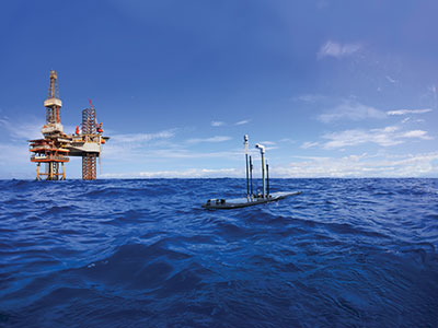
Wave Glider, monitoring in the Gulf of Mexico
Deepwater Horizon Explosion, Gulf of Mexico
Back in April of 2010, BP was faced with one of the biggest industrial oil spills in history. Located in the Gulf of Mexico at the Macondo Prospect, an oil rig explosion and subsea blowout resulted in 4.9 million barrels of oil released into the Gulf. BP, the US Government and local communities began a massive response to protect the environment and ecosystem from this disaster.
As part of BP’s multi-faceted response and long-term monitoring effort, they deployed four Wave Gliders to detect the presence of oil and to continuously measure water quality, including trace amounts of dispersed oil. Additionally, the Wave Gliders used acoustic sensors to monitor marine mammal activity.
Working around the clock, Senior Field Engineer Dustin Boettcher integrated sensors and deployed the Wave Gliders to collect data for baseline studies. These studies measured loop currents for mapping support, collected metocean data, measured hydrocarbons in seawater to detect chlorophyll and algal blooms and used Passive Marine Acoustics (PMA) for marine mammal monitoring. This information provided BP critical real-time insight to water quality as well to the health of the ecosystem.
During this six-month mission, Wave Gliders equipped operated successfully and safely through the most challenging areas and along the fragile coastlines. Together, the Wave Gliders along with Dustin’s expertise and mission planning resulted in the collection and transmission of an amazing amount of data and nautical miles traveled. The tallies were 8,669 nautical miles, 2.1M fluorometer points, 132,930 weather points, 78,759 ocean currents points, 2.56GB of acoustic data and 9,576 hours of Wave Gliders at sea.

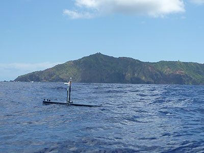
Patroling off the coast of Pitcairn Island
Pitcairn Islands, Home of Mutiny on the Bounty
Traveling around the globe, Danny Merritt, one of our senior field support engineers, is an expert on supporting remote locations. He’s calibrated compasses on the Wave Glider in locations like Barrow, Alaska, captured Wave Gliders transiting shipboard through the Suez Canal on their way to a large fleet deployment, worked from field sites throughout Japan, and supported scientific missions off the coast of South Africa.
One of his most challenging assignments was to journey to the Pitcairn Islands, home to the Mutiny on the Bounty. Along with this notoriety, the Pitcairn Islands is home to the UK’s largest marine protected area. Just south of the Tropic of Capricorn in the French Polynesian Islands, this 834,334 square kilometer (322,138 sq mi) marine preserve is one of the world’s most pristine ocean habitats. It’s home to fish and fauna not found anywhere else in the world, and at risk due to illegal fishing. How do you protect this habitat when you’re the farthest point from land and in the middle of the Pacific Ocean? A place where ships depart only every three months? Answer: use Wave Gliders to detect suspicious ships entering the MPA. Working with the UK’s Foreign and Commonwealth Office, we sent a Wave Glider for a four-month surveillance mission of the Pitcairn Islands. Rising to the challenge, Danny was instrumental in working with the local authorities and our partners to plan and execute this mission.
After successfully completing its mission, the Wave Glider swam more than 2,808 nautical miles (5200 km) — through strong equatorial currents, doldrums, and challenging sea states — back to port in Hawaii. Along the way, it collected 9,516 measurements of meteorological, oceanographic, and marine biodiversity data over expanses rarely traveled. Altogether, the Wave Glider was continuously at sea, untouched, for 213 days while traveling a total of 7,205 nautical miles (13,344 km).

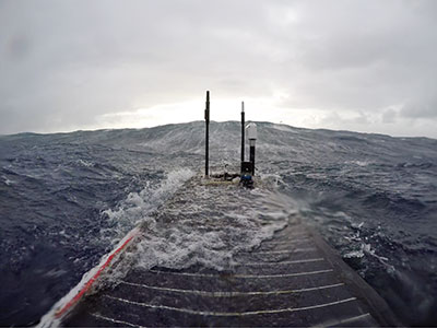
Onboard camera shows big waves encountered
Wave Glider Testing Off of Iceland
Teaming with Dr. Eric Terrill of Scripps Institution of Oceanography, we journeyed to Iceland to deploy our next generation Wave Glider prototype for testing in an extreme environment. For those unfamiliar with the geography, Iceland is at the juncture of North Atlantic and Arctic Oceans and south of the Arctic Circle. Some of the most treacherous ocean conditions exist off the coast with sustained high sea states and strong currents. In the winter months, this is the perfect location to test how our platform performs for extended periods in ocean conditions with sea states as high as 8 and 9. A monumental challenge.
Our challenge was to design for an environment that’s so inhospitable there is no data characterizing the operating conditions. We had plan for the worst corner case and double it. Working with Scripps and Engineering, our Mission Services team worked on a detailed mission plan, outlining and creating plans with contingency plans to address the extreme operational conditions. In the end, we learned a lot, made adjustments and conducted more testing to achieve mission success.
Time and again, we count on our Mission Services team to rise to the challenge and help ensure mission success.
